
| Arches NP | ||
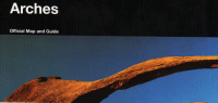 Park Map |
Synopsis: Geological park of natural arches in various development stages as well as other rock formations. Stamp Location: Visitor Center right off US 191, just after entrance station north of Moab. |
|
| Bryce Canyon NP | ||
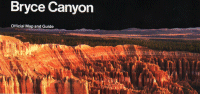 Park Map |
Synopsis: Geological park of most unusual nature. Horseshoe shaped amphitheaters with thousands of standing colorful rocks called hoodoos. Stamp Location: Visitor center is located 3 miles from SR 12 on SR 63. |
|
| California NHT | ||
 Park Map |
Synopsis: Trail covers historic route of the largest land migration in the nations history. Stamp Location: Site in Utah with the stamp: the National Trails System Office 324 So State St, Suite 250 in Salt Lake City. See also Idaho, California, Wyoming, Missouri, Iowa and Nebraska for additional stamp locations. |
 |
| Canyonlands NP | ||
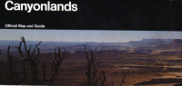 Park Map |
Synopsis: Geological park of numerous canyons and massive rock formations. Be sure to visit the Needles district and enjoy the ride in. Stamp Location: The Island in the Sky visitor center is located 32 miles north of Moab on SR 313 off US 191 and the Needles Visitor Center is located 49 miles west of Monticello on SR 211 off US 191. Stamp is also available for the Maze District at the Hans Flat ranger station 46 miles east of SR 24 and at the Southeast Utah Group Administrative Offices on US 191 3 mi. south of Moab. |
|
| Capital Reef NP | ||
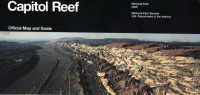 Park Map |
Synopsis: Geological park protecting 100 mile long colorful rift in earth’s crust. Stamp Location: Visitor center located 11 miles east of Torrey on SR 24. |
|
| Cedar Breaks NM | ||
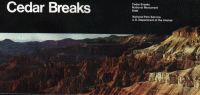 |
Synopsis: Geological park much like Bryce Canyon (perhaps even a little more colorful), except the rim is above 10,000′ in elevation, making it rare for such a formation. The area is surrounded by an alpine environment. Stamp Location: Visitor center is located jus off SR 14 on SR 148 ouside of Cedar City, and is open June – mid-October only. Winter information can be obtained at the Kolob Canyons Visitor Center in Zion Canyon NP. |
|
| Dinosaur NM | ||
 Park Map |
Synopsis: The only site in the park system to protect a historic dinosaur quary also protects the last free flowing river in Colorado (the Yampa). Stamp Location: Visitor center off SR 149 (off US 40 near Jensen) at the Dinosaur Quary (the only place to see fossils). See also Colorado for additional stamp locations. |

|
| Glen Canyon NRA | ||
 Park Map |
Synopsis: Scenic water and backcountry area of southern Utah that helped give rise to the modern environmental movement. Stamp Location: Known locations are the Bull Frog VC where SR 276 meets the lake (actually, its on top of a hill over looking the lake an marina), the Interagency VC in Escalante and the ranger station in Hite. At the Halls Crossing Ranger Station (on the southside of the lake on SR 276) & the Dangling Rope Marina (& Ranger Station which is only accessable by water), you should be able to get your book stamped if the ranger contact stations are open, however staffing at these locations are seasonal and intermittent. See the official site for more information. See also Arizona for additional stamp locations. |
|
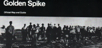
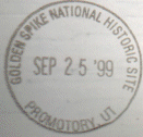
| Golden Spike NHS | ||
 Park Map |
Synopsis: Park preserves site of the first meeting place of the east and west railroads, creating a transcontinental passage. Re-enactments and other programs are offered as well. Its even possible to drive on a portion of the original rail bed, though a 4×4 is recomended. Stamp Location: Park visitor center, located off SR 83, 32 miles west of Brigham City and I-15. |
|
| Hovenweep NM | ||
 Park Map |
Synopsis: Park protects five prehistoric, Puebloan-era villages spread over a twenty-mile expanse of mesa tops and canyons along the Utah-Colorado border. Stamp Location: The parks visitor center is accessible from White Mesa (south of Blanding) on Highway 262. See also Colorado for an alternative approach. |
|
| Mormon Pioneer NHT | ||
 |
Synopsis: Over 70,000 Mormons led by Brigham Young travelled this route from Illinois to the Salt Lake Valley. Stamp Location: The stamp is available in Wyoming at the National Trails System Office 324 So State St, Suite 250 in Salt Lake City. See also Nebraska, Wyoming and Iowa for additional locations. |
|
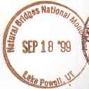
| Natural Bridges NM | ||
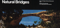 Park Map |
Synopsis: Park preserves three natural bridges carves by water out of stone. Its the oldest NPS site in Utah. Stamp Location: Stamp may be obtained in the visitor center located along SR 27 before the one way loop to look at the bridges near Blanding. |
|
| Oregon NHT | ||
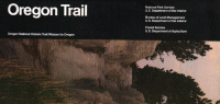 |
Synopsis: Preserves and interprets historic path of emigrants to Oregon and the Northwest. Stamp Location: Site in Utah with the stamp: the National Trails System Office 324 So State St, Suite 250 in Salt Lake City. See also Idaho, Washington, Wyoming, Nebraska, and Missouri for additional stamp locations. |
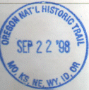
|
| Pony Express NHT | ||
Park Map |
Synopsis: Trail was used by young men on fast paced horses to carry the nation’s mail across the country, from St. Joseph, MO to Sacramento, CA in the unprecedented time of only ten days. Stamp Location: Site in Utah with the stamp: the National Trails System Office 324 So State St, Suite 250 in Salt Lake City. See also Nebraska, Missouri for additional stamp locations. |
|
| Rainbow Bridge NM | ||
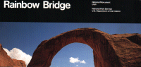 Park Map |
Synopsis: Park protects the largest natural bridge in the world. Stamp Location: Stamp is available at the Bull Frog VC where SR 276 meets the lake (actually, its on top of a hill over looking the lake an marina), The Hite Ranger Station and the Interagency VC in Escalante. Bridge is only accessable via boat or a 13 mile hike. See this page for information about boat tours. See also Arizona for an additional stamp location. |
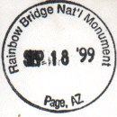
|
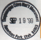
| Timpanogos Cave NM | ||
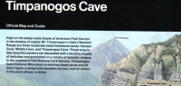 Park Map |
Synopsis: Park preserves cave high in the Wasatch Mountains. Park is situated in rugged, steep canyon. Very scenic.Note: Actually visiting the cave requires a 1.5 mile hike that gains over 1,000′ in elevation Stamp Location: The stamp is at the visitor center at the base of the mountain right off SR 92 east of American Fork. |
 |
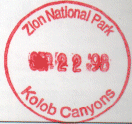
| Zion NP | ||
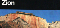 Park Map |
Synopsis: Park protects spectacular cliff-and-canyon landscape and wilderness full of the unexpected including the world’s largest arch, Kolob Arch. Like Yosemite in color. Stamp Location: Stamp is available in the main visitor center just inside the park north of Springdale on SR 9 and at the Kolob Canyons VC, exit 40 off I-15. |
 |
